

You can find on this page the Manhattan bike map to print and to download in PDF. The Manhattan bicycle map presents the bike routes and lanes of Manhattan in USA.
The Manhattan bike lane map shows all the bike routes of Manhattan. This bicycles lanes map of Manhattan will allow you to easily plan your routes with a bike in Manhattan in USA. The Manhattan bike lanes map is downloadable in PDF, printable and free.
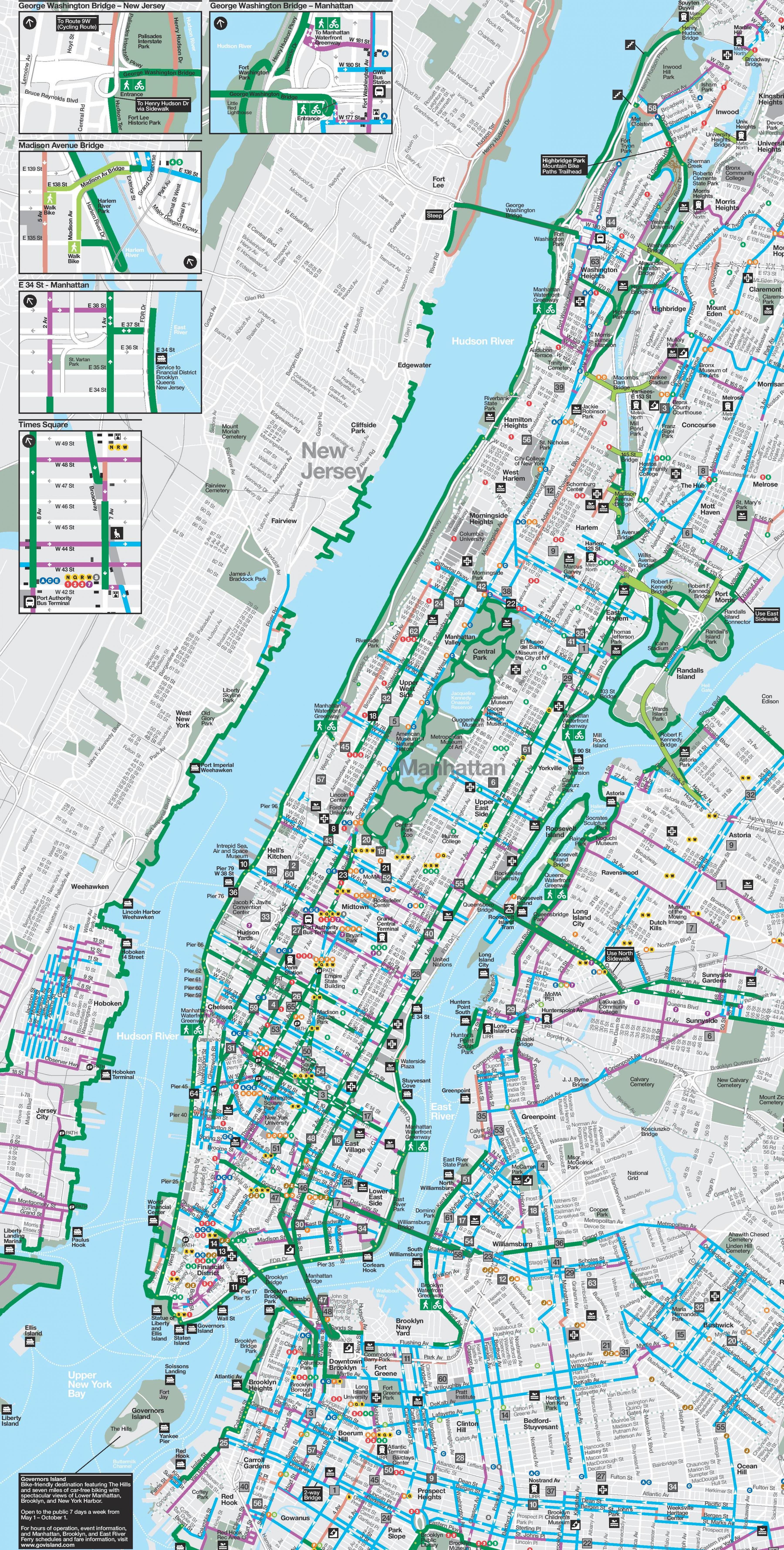
On Waterfront Greenway of Manhattan, you will enjoy biking, it is quite simple because there are mostly real bike paths reserved for bicycles as its mentioned in Manhattan bike lane map, while Cars drive on their own roads. Higher up, you still have to be careful because some parts of the lane are really in the middle of the street and I must admit that it is scary. They are sometimes illegible, used by buses or taxis.
For this first bike ride in New York City, departure start from the Brooklyn Esplanade, located in the Brooklyn Heights district as its shown in Manhattan bike lane map. From this lane reserved for pedestrians and cyclists, you will be able to admire the Manhattan skyline that faces you, on the other side of the East River. The long wooden footbridge over the Brooklyn Bridge overlooks the car lanes.
Brooklyn has the most bike lanes. On the other hand, biking around Manhattan is more risky. We do not recommend it if you are traveling with young children or if you are not too experienced. The network of bike lane is available in Manhattan and Brooklyn and offers a fleet of 10,000 bikes spread over 600 stations attracting an average of 42,000 users per day as you can see in Manhattan bike lane map.