

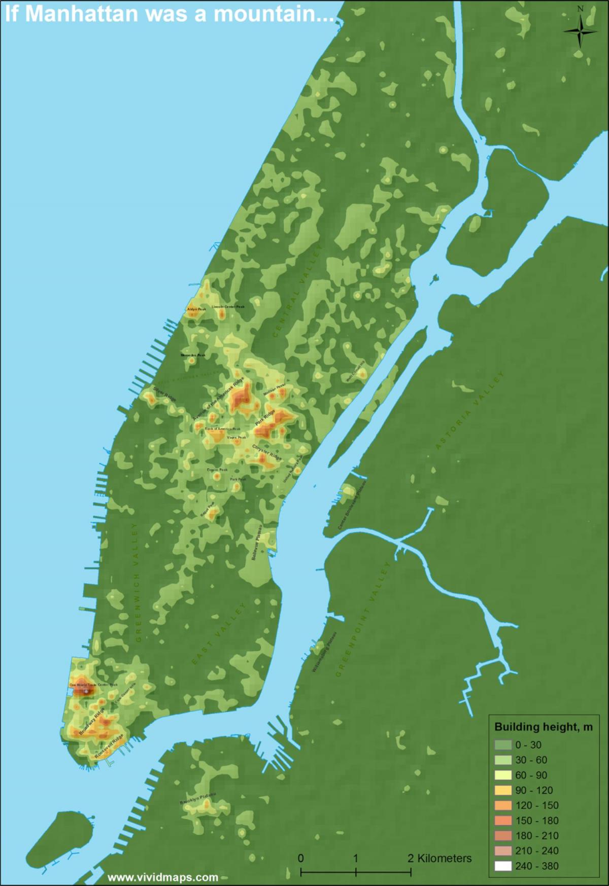
You can find on this page the Manhattan topographic map to print and to download in PDF. The Manhattan elevation map present the topography, river and relief of Manhattan in USA.
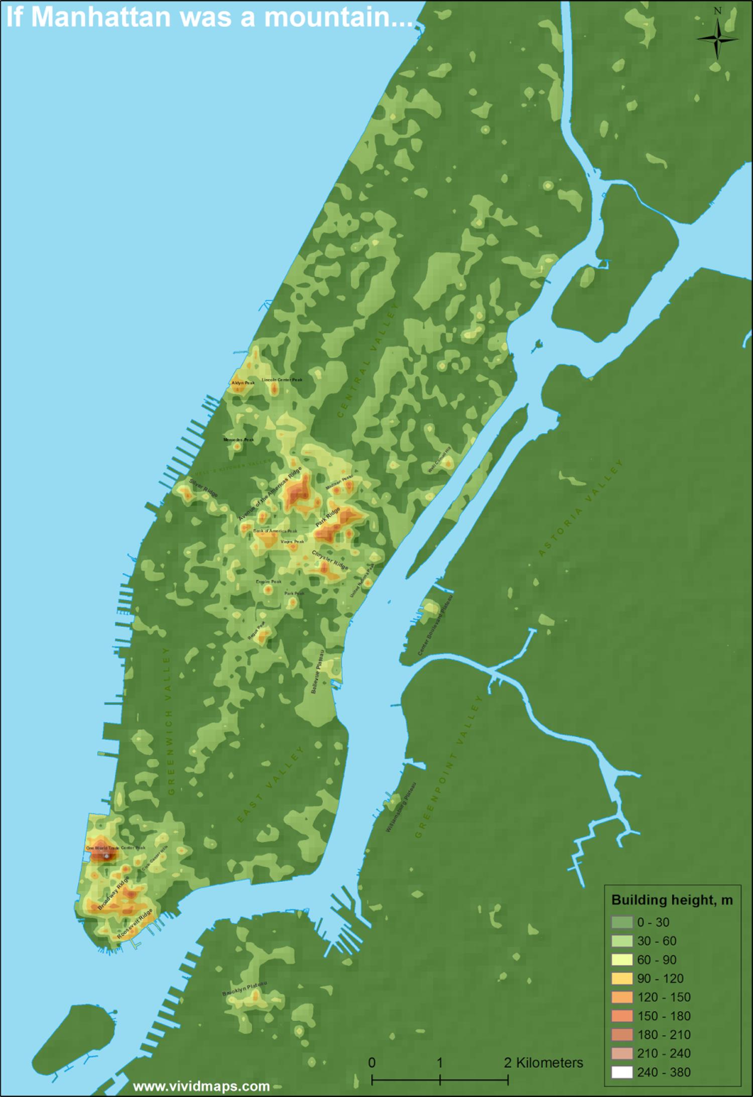
The Manhattan topographic map shows elevation, hills and landforms in Manhattan. This elevation map of Manhattan will allow you to know topography, river and relief of Manhattan in USA. The Manhattan topographic map is downloadable in PDF, printable and free.
Marble Hill as the highest elevation point in Manhattan, is one example of how Manhattan land has been considerably altered by human intervention. The borough of Manhattan has seen substantial land reclamation along its waterfronts since Dutch colonial times, and much of the natural variation in its topography has been evened out (see Manhattan elevation map).
Sure, at 265 elevation feet above sea level, it is not exactly very high (see Manhattan elevation map). But when earthquake–triggered waves crash over Manhattan and you have no idea where to go, head to Bennett Park. it is a sweet little park—Manhattan borough highest ground—in Washington Heights on Fort Washington Avenue and 183rd Street. The nearby area played a crucial role in American history. Called Long Hill by early Dutch settlers, it became George Washington operations base during the Revolutionary War, thanks to its vantage elevation point.
Bennett Park located at West 183rd Street & Fort Washington Ave, the highest elevation point of land in Manhattan, the site was home to Fort Washington during the Revolutionary War, the base of operations for Washington. There is an official plaque set into the rock, marking it as 265.05 feet above sea level (yes, that is .05 feet, as in 3/4ths of an inch) as its shown in Manhattan elevation map.